Flood information
 The Fraser Coast Region has a long history of flooding.
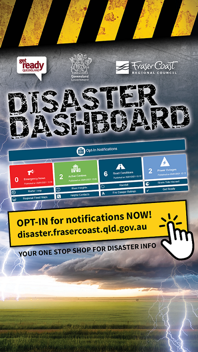
During flood events, please follow the Fraser Coast Disaster Dashboard for current information.
You will also find updates on the Fraser Coast Regional Council Facebook Page and Website.
Click on the link below to explore online maps for flood height predictions and storm surge evacuation zones:
What should I do to prepare for floods?
- Visit the Community Portal to learn about flooding in your area
- Understand your flood risk – Contact the Fraser Coast Regional Council to ask about the flood risk for your property on tel: 1300794929
- Prepare a household emergency plan
- Pack an emergency kit in case you need to leave
- Tidy up around your home
- Protect your vehicle, caravan and boat
Monitor Conditions
- Stay tuned to the Bureau of Meteorology flood warnings.
- Opt-in for notifications from the Fraser Coast Disaster Dashboard. The Disaster Dashboard shows flood cameras, road conditions, emergency news and also has Regional Flood Maps and Storm Tide Maps
- Follow Fraser Coast Regional Council on Facebook for updates during a flooding event.
Other Resources
Fraser Coast has two river catchments:
1. Burrum/Cherwell River
The Burrum River catchment covers an area of about 935 square kilometres which includes its major tributary, the Cherwell River, with a catchment area of about 200 square kilometres. The headwaters of the Burrum River are in the Sea View Range to the west of Hervey Bay.
The main flood affected area is the Pacific Haven Estate which lies on the Cherwell River just upstream of the Burrum River junction. Heavy rainfall in the Cherwell River catchment can cause rapid river rises at Pacific Haven and travel times are very short. Pacific Haven is also susceptible to backwater flooding from the Burrum River and flood levels can also be affected by higher than normal tides and storm surges.
2. Mary River
The Mary River catchment is one of the most diverse catchments in Queensland, covering 9595 km2. From its source, the Mary River flows north through the towns of Kenilworth, Gympie, Tiaro and Maryborough before emptying into the Great Sandy Strait, a passage of water between the mainland and K'gari, near the town of River Heads, 17 km (11 mi) south of the town of Hervey Bay.
Average annual rainfalls in the Mary catchment range from around 2000mm in the headwaters to around 1200mm near Maryborough. At Gympie, most floods, nearly 80%, have occurred between December and April.
Flood Level Classifications
At each flood warning river height station, the severity of flooding is described as minor, moderate or major according to the effects caused in the local area or in nearby downstream areas. Terms used in Flood Warnings are based on the following definitions.
|
Minor Flooding : Causes inconvenience. Low-lying areas next to watercourses are inundated. Minor roads may be closed and low-level bridges submerged. In urban areas inundation may affect some backyards and buildings below the floor level as well as bicycle and pedestrian paths. In rural areas removal of stock and equipment may be required. Moderate Flooding : In addition to the above, the area of inundation is more substantial. Main traffic routes may be affected. Some buildings may be affected above the floor level. Evacuation of flood affected areas may be required. In rural areas removal of stock is required. Major Flooding : In addition to the above, extensive rural areas and/or urban areas are inundated. Many buildings may be affected above the floor level. Properties and towns are likely to be isolated and major rail and traffic routes closed. Evacuation of flood affected areas may be required. Utility services may be impacted. |
